
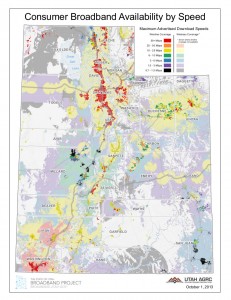
The Utah Broadband Outreach Center in the Governor’s Office of Economic Development (GOED) released an updated residential broadband map today, providing an enhanced tool to help businesses and consumers locate...
Last updated: February 1, 2016
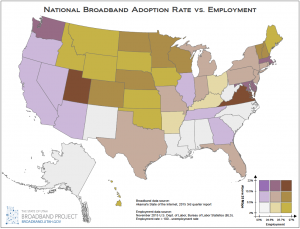
January 2016 Map of the Month: Broadband Access & Employment
Happy New Year and welcome to the first 2016 installment of the Broadband Outreach Center’s Map of the Month series. This month we’ve mashed up two state-by-state level datasets that,...
Last updated: January 21, 2016
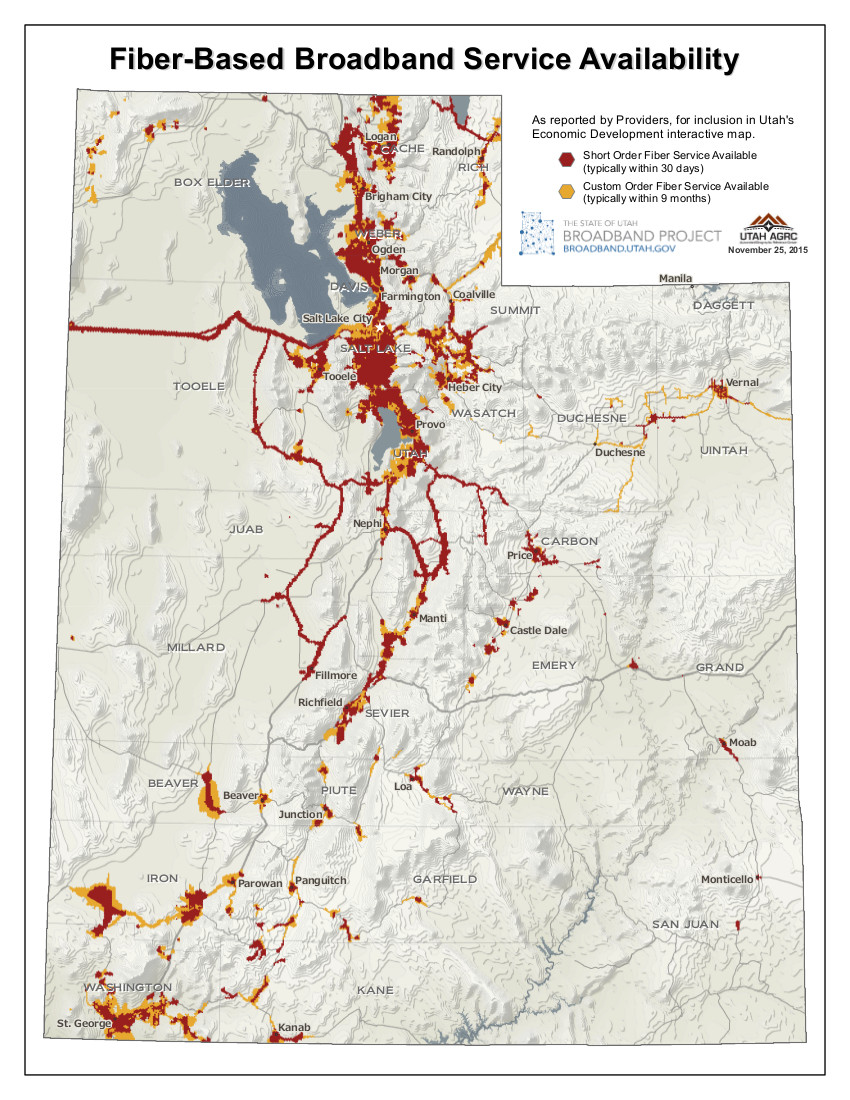
November 2015 Map of the Month: Commercial Fiber Service Availability
The November 2015 Map of the Month shows, at a statewide scale, the current commercial fiber-based broadband service availability reported to the Broadband Outreach Center for inclusion on the locate.utah.gov...
Last updated: November 25, 2015

Pew Analysis Shows Comparisons between Utah and National Broadband Adoption Trends
The results of a 2015 survey that Pew Research Center conducted concluded that 15 percent of U.S. adults do not use the Internet for various reasons: the top three being...
Last updated: August 12, 2015

December 2014 Map of the Month: Utah’s Changing Broadband Landscape Update
This month, the Utah Broadband Project’s mapping team updated October 2013’s Map of the Month, which mapped the increase in maximum advertised download speeds per populated place over the course...
Last updated: December 16, 2014
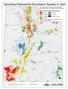
April 2014 Map of the Month: Utah Broadband Landscape at a Glance
Twice a year, the Utah Broadband Project updates the statewide broadband coverage map data. Utah’s latest update was submitted to the Federal Communications Commission (FCC) and the National Telecommunications and...
Last updated: April 17, 2014
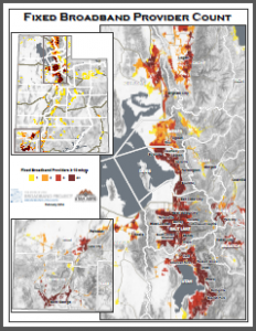
February 2014 Map of the Month: Number of Fixed Broadband Providers per Block
This month’s installment in our Map of the Month series looks at the number of broadband providers capable of providing a ‘fixed’ broadband connection at a defined advertised speed threshold...
Last updated: February 21, 2014
Fall 2013 Broadband Data Submission
In preparation for the Fall 2013 Data Submission to the Federal Communications Commission (FCC) and the National Telecommunications and Information Administration (NTIA), the Utah Broadband Project worked with 54 broadband...
Last updated: October 11, 2013
FCC Announces Changes to Broadband Data Collection
The FCC recently announced that beginning in September 2014, broadband data collection responsibility will shift from NTIA and state entities (such as the Utah Broadband Project) to the FCC through...
Last updated: July 16, 2013