The 2018 general session of the Legislature kicks off on Monday, January 22nd so, our January 2018 Map of the Month, has an appropriate theme. This month, we’re taking a...
Last updated: January 16, 2018
December Map of the Month: Utah’s Address Points, a Critical Digital Asset
Our December 2017 Map of the Month highlights Utah’s statewide “Address Point” map layer — a vital, statewide information asset. The Address Point map layer is a collection of all...
Last updated: December 21, 2017
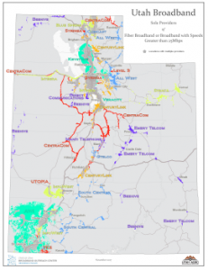
November 2017 Map of the Month: Sole Provider Areas
There are still quite a few areas in Utah that have a sole provider of high speed broadband service. This is more likely in rural communities and remote areas where...
Last updated: November 22, 2017
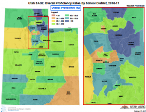
October 2017 Map of the Month: Utah SAGE K-12 Test Scores
Our October Map of the Month depicts proficiency rates, from the Student Assessment of Growth and Excellence (SAGE) tests conducted across Utah’s 41 school districts....
Last updated: October 23, 2017

September 2017 Map of the Month: ‘Extra Coverage’ in the FCC Form 477 Broadband Maps
Our September map of the month revisits a topic that we explored in October of 2014 — how Utah’s broadband coverage is overrepresented in the Federal Communications Commission’s (FCC) Form...
Last updated: September 21, 2017
August 2017 Map of the Month: Fiber and Other Maps from UDOT’s UPlan Site
The August broadband map of the month is the collection of map data and viewers that comprise the UDOT UPlan interactive map website. This choice was inspired by a presentation at...
Last updated: August 30, 2017
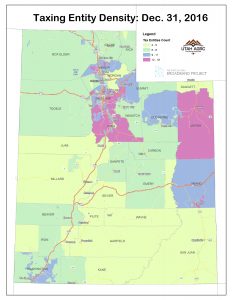
March 2017 Map of the Month: Utah’s Local, Special Service, and Redevelopment Districts
Local and special service districts are an important user constituency for broadband services. In addition to broadband use at district headquarters, many are also dependent on broadband for field and...
Last updated: March 14, 2017
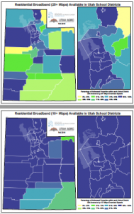
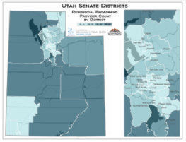
January 2017 Map of the Month: Broadband in Utah’s School Districts
To celebrate the upcoming launch of the Utah Science, Technology, Engineering and Math (STEM) Bus, the Broadband Outreach Center recently did an analysis of residential broadband coverage in each of...
Last updated: January 26, 2017
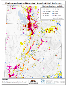
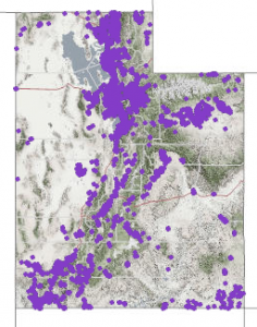
July 2016 Map of the Month: Broadband Metrics from Address Points
The July 2016 Map of the Month mashes Utah’s map layer of addressed property locations with the highest advertised speeds for residential class broadband service statewide. The results show, in map...
Last updated: July 29, 2016
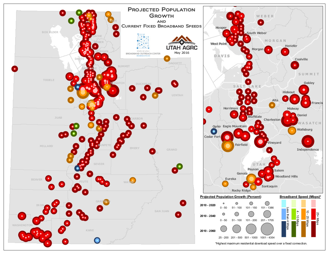
May 2016 Map of the Month: Utah Population Growth Estimates
Utah’s population is on track to more than double by 2060, making it crucial to build and design critical infrastructure with the current, and future, population in mind. This month’s map...
Last updated: May 26, 2016