The federal-level First Responder Network Authority (FirstNet) issued its Request for Proposals (RFP) for the deployment of the nationwide public safety broadband network on January 13....
Last updated: February 4, 2016
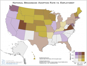
January 2016 Map of the Month: Broadband Access & Employment
Happy New Year and welcome to the first 2016 installment of the Broadband Outreach Center’s Map of the Month series. This month we’ve mashed up two state-by-state level datasets that,...
Last updated: January 21, 2016
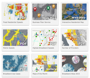
December 2015 Map of the Month: New Online Map Gallery
Since its inception in April 2012, over 40 maps have been published in the Utah Broadband Outreach Center‘s Map of the Month series. And, that’s in addition to the BOC’s...
Last updated: December 23, 2015

Jan 15 Map of the Month: Visualizing Broadband Drive Tests
The Utah Broadband Project contracted with Isotrope, LLC to perform a mobile broadband drive test along over 6,000 miles of Utah’s highways and major roads. This dataset was used for...
Last updated: January 24, 2015
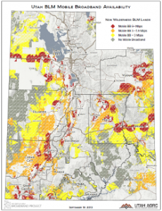
Sept 2013 Map of the Month: Mobile BB on USFS and BLM Land
Over 66% of Utah’s lands are owned and administered by the federal government and its agencies. Among the 50 states, only Nevada has a higher percentage. States with a large...
Last updated: September 19, 2013
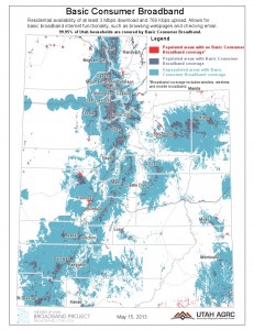
May 2013 Map of the Month: Speed-based Use Cases and Populated Areas
The Utah Broadband Project’s May 2013 map of the month displays Utah’s populated areas with broadband coverage areas for 3 different levels of service. The data sources are residential and mobile...
Last updated: May 20, 2013